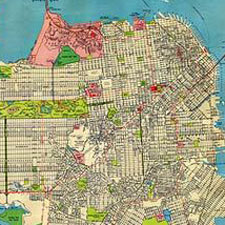
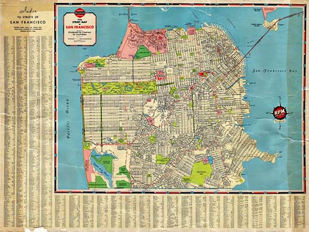
By 1938 the essential outlines of the city were filled in and established. Some names have changed — I didn’t know that Fort Point was called Fort Winfield Scott. The location of Funston Park was called Lobos Square. USF was the San Francisco College of Women. There were “bear cages” in the park, as well as “elk and deer corrals.” And so on.
A large (5800 x 4358 px) image of the map is here.
lisa ann
can I buy a copy of this old map or a re-make? I am looking for a map to buy of the different neighborhoods of SF it has to have streets on it also any suggestions?